We get up the next morning, get ready, and go to the Grand Canyon. It is everything everyone claims it is. A gorgeous, giant hole in the ground, it stretches 10 miles across in front of us. We take pictures, footage, and souvenirs, and then head out. Koji requests that we stop at the Planes of Fame Air Museum on the way back to I-40. It is a VERY cool place for anyone interested in planes. We stop, take some pictures, buy some souvenirs, and get back on the road. Next stop, Meteor Crater just outside of Flagstaff, about 2 hours away. The drive back to I-40, which took us 2 hours the night before, takes us half the time this afternoon.
We mosey on down the road, find the road for Meteor Crater, and head on up. Six miles up the road, we come to a partially closed gate with a security guard sitting in a parked truck. Meteor Crater is closed. It closed at 5pm. It’s 5:10 now.
How exactly do you close a mile-wide hole in the ground? Sarah’s mother wants to know if they pull a tarp across it.
Thwarted, we return to Meteor Crater Road (Arizona is not very creative with their road names) and pull over on a “Primitive Road” (I got pictures) and catch a glorious sunset over the mountains. It almost makes up for being 10 min too late to see the crater.
Almost.
Back on the road again, we continue towards Albuqueque, our final destination for the night. It’s now full dark, but at least the road is pretty much straight. For awhile.
About 2 hours from Flagstaff, with about 3 more hours to go, Sarah takes over driving.
Then the fog returns.
Pea soup, can’t see the 18-wheeler 100 yards ahead of us, fog.
Of all the ridiculous nonsense. Where does fog in New Mexico even come from?
We were making really good time, but now we’re back to 50 mph on the freeway. The fog is patchy for the next hour. We don’t get in to Albuqueque until 10pm. Wonderful. We’re going along the freeway towards the hotel, when about 5 or 6 miles from the exit we need to take, the road construction begins. Our exit is closed. We go to the next exit, helped along by Koji and Maxx (Koji’s GPS Navigator) and start down the road for the hotel. We get to where it should be, and it’s not there. What do I mean, it’s not there? Well, we were looking for the Best Western on Central Ave. There is no Best Western on Central Ave. We loop around and call the number from the website. Nobody answers. We loop around again and call information. Information gives us the number to Barcelona Suites on Louisiana. We drive to it and the sign is Best Western, only the Best Western part is covered (you can still tell it used to be a Best Western; their signs are very distinctive). Barcelona Suites bought the Best Western about a month ago. Information didn’t even know about it. So the guy at the desk at the Barcelona Suites (which, by the way, looked fabulous, in case anyone is unfortunate enough to have to go through Albuqueque) was extremely helpful and actually looked up the Best Westerns website for us. No Best Western on Central Ave. We call the closest one to our location. They don’t have our reservation. We call Central Reservations for Best Western. They don’t have a reservation for us either. We call the number for the hotel one more time, and they finally answer.
It’s a Best Choice Inn, not a Best Western, but the man that answers the phone mumbles, has an accent, and talks really fast. He directs us back to where we started and, sure enough, there’s the Best Choice Inn. We get our key and immediately go in search of food (because we’re all very cranky at this point) and then go upstairs and eat and go to bed. We’re not too worried about time because we don’t have to get up too early as we’re just driving from Albuqueque to Carlsbad, a 3 hour drive. (yeah, right!)
After we get up the next morning, I notice that we only have three bath towels. As two of us have hair, we need at least one more bath towel. So I go downstairs and ask for another towel. He asks when we're checking out. Today, as our reservation states. He says that there are 8 towels in the room. *insert crazy look here* No, there are three towels, I explain. He says no, all rooms get 8 towels. Again, no, there are only THREE bath towels in the room. He begins to list them, three bath towels, three washcloths, bathmat...
Seriously? Am I supposed to dry my hair with the bathmat then? Give me my damn towel! He finally gives in. Towel in hand, I go back to the room, and 20 minutes later we're back on the road.
We’re heading south out of Albuqueque, and we are in serious need of some coffee. We end up in the barrio, get lunch at Subway, and then my Dad comes through (once again!) and finds us a Starbucks in Los Lunas, a sprouting of a city that looks like its sole purpose is to support the huge mall they have there. We get coffee and head south to Socorro, our first pit stop.
What’s in Socorro, you ask?
The Very Large Array (VLA).
What’s the VLA?
Ever seen Contact?
That’s the VLA. It is awesome.
We get to Socorro, find the sign that points us in this direction, take that road. Only that road dead ends at the desert. We turn around, and take a different road, and that road has no signs and we’re about to head right out of town. We decide to stop and ask directions at the last building, a vet’s office. We’re going the right way, they tell us, and they are confirmed when a quarter mile down the road we see a sign that tells us the mileage to the VLA. Of course.
This road, by the way, is a two-lane back road in the middle of the New Mexico hills (I think they call them mountains, but really they’re just cute baby mountains). It’s very scenic, and we’re enjoying the drive. 50 miles later, we actually see the first array. I’m sure most of you don’t want to hear about our visit at the VLA, as the vast majority of the three people who will read this are not the science nerds that we are.
Back to the travel.
After we get back to Socorro (after having caught yet another glorious sunset off that New Mexico back road) we head to our next stop which is Roswell via the other tiny back road cross White Sands Missile Range. At this point in our journey we are second guessing the wisdom of driving across the northern end of a missile range. With the luck we’ve been having, they’ll miss the safe zone.
But we were not hit by rogue missiles. We made it through just fine (after I pass a stupid UHaul truck doing 40 in the 65 on a completely unlit blind curve at night).
Finally at Roswell, we stop for dinner at a Sonic. Lo and behold, our carhop is half Inupiat. Grew up in Anchorage and Palmer, and moved to Texas and then New Mexico several years ago. Of course. He was very nice though, and gave us directions to the road to Carlsbad and directions to the Walmart where we could get alien postcards. How can you stop in Roswell, NM, and not get alien postcards? We get to the Walmart, but they don’t have any alien postcards. What they do have is an entire room of souvenirs. Not as many as the Anchorage Walmarts, but still more than I’ve seen in any other Walmart outside of Alaska. Ever. Only no postcards.
Back on the road, we head towards a gas station, ANY gas station, that might have alien postcards. None. We finally stop at a Walgreens (Walgreens! How I miss drugstores!) and they have a couple. Postcards in hand, we get back on the road and drive back through town. By the way, if you’ve never been to Roswell, their downtown streetlights are actually green alien heads. Fantastic.
It’s only 75 miles from Roswell to Carlsbad, but there’s construction on the road, so the speed limit was 55. Lucky us. We finally get into Carlsbad at midnight, get to our hotel room, relax for a few minutes, and then Sarah’s phone tries to tell us that we’re in Central Time and it’s now2:45am.
Excuse me? We just lost an hour??
No, no, we’re still in Mountain Time. Panic averted.
See, we were planning on going to Carlsbad Caverns the next morning and then going to the McDonald Observatory in Fort Davis (our next stop) that afternoon. It was only about a 4 hour drive from Carlsbad to Fort Davis. So we get up super early after a super late night, get to Carlsbad, do a whirlwind tour through the Big Room, and then decide that we’re going to stay an extra night in Fort Davis and go to the Observatory tomorrow, so as not to kill ourselves on the drive down. We have a leisurely lunch at Jack’s, which is the Family Dining half of the Velvet Garter Saloon & Restaurant. Jack’s, just so ya know, is an awesome place. They have Galaga, in the original arcade =) As well as Cruisin USA, Ms. Pac-Man, and Area 51. We bought fudge across the street, and then head south towards Texas.
Ah, Texas. Home.
We went through the Guadalupe Mtns National Park, and actually had a good drive down through back road Texas to get to Fort Davis. Catch another glorious sunset by the Observatory, and then head into Fort Davis. It takes us 30 minutes to wind 15 miles through the Davis Mountains. We finally come to the town of Fort Davis (quaint little thing) and we can’t find the place we’re staying, the Butterfield Inn. Mapquest is telling us one thing, but the actual address is telling us a different story. We choose the address, and head that way. Ta-da! There it is! And they are adorable! They’re little one room cottages. If you should ever find yourself in Fort Davis, TX, stay at the Butterfield Inn.
That brings us up to date. Of course, there’s no wifi or even wired internet here, so I can’t upload any of the blogs I just wrote. But I will upload them soon, and then this paragraph will be defunct.
And now, to bed. Tomorrow, we will sleep in and then go to the Observatory. Yay!
Friday, January 9, 2009

The Saga Begins
Vegas.
What a gloriously well-lit city. It’s a nine hour drive from Sacramento to Vegas, and I didn’t get in til well after dark. And, as it’s famous for, I could see the bright lights of Vegas shining behind the mountain from about 40 miles away. Awesome.
I get into Vegas, and I’m staying at the Luxor which is on the Strip. The center of Vegas, the one place you go when you go to Vegas.
Yes, of course I got lost.
I knew it was across from the airport (thanks to Google Maps; I LOVE Google Maps) and so I took the exit for the airport thinking it would be right around the corner. Well, it was, but I didn’t go far enough. So I call my Dad (really, what would I do without him?) and he directs me down this other road. I get on the right road and I get to the Strip and take a right. Yes! I’m on my way, it’s just up here.
Twenty minutes later, I’m still on the strip heading straight for darkness. I call my Dad back and I tell him I don’t think I’m going the right direction because the bright lights of Vegas are now behind me. He checks the map, and sure enough, I’m heading the wrong direction. Remember back when I turned right?
Left. I should have gone left.
So I hook a Uie (how does one spell that?) and go towards the light.
Thirty minutes later, I finally find the Luxor. Perfect!
Only now I can’t figure out where to park. I circle, loop back around, circle on the wrong road, loop around again, and finally figure out where to park. Yes, there are signs, but they’re very tiny and they’re RIGHT WHERE YOU TURN. How bout some advance warning?
Park in the garage, get all my crap out, and hike the half mile into the building, then the other half of the mile to the registration desk, check in, get to my room, and order room service. I’m texting Sarah, as she’s supposedly getting on a plane in a couple hours to get to Vegas tomorrow morning, when she tells me her flight out of Anchorage has been delayed, 2 hours. This is not a disaster, as they have a 3 hour layover in Seattle before flying on to Las Vegas, NV. So it’s 2am AKST before they finally lift off, 7am before they finally get to Seattle with 30 minutes to spare to make their connecting flight. I get much needed rest in a glorious hotel room, and I pick them up at the airport. We go back to the Luxor, rearrange luggage so I can actually fit the extra two people in my car, and play a few slots, take a few pictures, buy a few souvenirs, and eat lunch in the Atrium.
The plan after lunch is to drive from there to the Grand Canyon, where we will go on the Skywalk the following day. We have a room reserved 1 mile from the entrance, and we’re super excited. Of course we get a late start out of Vegas, so we don’t get to the Hoover Dam until just after dark. Still cool, just not conducive to taking pictures or stopping at the visitor’s center for postcards. So we continue on down the road towards Kingman, AZ, where we will hit the road we need to take to get to the other road we need to take to get to the Grand Canyon hotel.
About an hour out from the Hoover Dam, it begins to snow.
Yep, ya read that right.
It is snowing on us in Arizona.
Fantastic.
So it’s full dark, windy mountain roads, snowing, and getting later by the minute. It took us four hours to get from the Hoover Dam to Kingman, AZ. For those of you who have never driven that road, it’s about 70 miles.
Four hours to go 70 miles.
Once in Kingman, we stop for gas and pull out the map. How much further do we have to go? As we’re perusing the page, we notice the sign for the Grand Canyon Skywalk.
We passed the road to get to it 65 miles back.
We will not be doing the Skywalk.
We’re very bummed about this, as the Skywalk looks so cool, but there is no way we’re turning around now. Onwards and upwards.
So we take the road further, find our turn for the next road, and it begins to snow even harder. I’m talking blinding, driving, Alaska snow. In freakin Arizona. We finally get to Williams, AZ, where the next (and last, thank God) turn is and pull into a gas station to ask directions to the Denny’s so we can have dinner. It is 10:30 at this point, and we’re exhausted, frustrated, and disappointed. And now, there’s a foot of snow on the ground. At least we all have experience driving in the snow. Poor Sarah and Koji though, they take a vacation to the desert and get snowed on.
We get back on the road after dinner, find the turn off, and we’re very excited because it’s only 50 miles down this road to the hotel. Whoo hoo!
Only the road is icy, so we can’t go faster than 50. Ok, so it’s gonna be a little while longer til we get there. We’re on the right road, and we’re going forward. That’s what matters.
Then the fog settles.
I’m talking pea soup fog, I can’t see 10 feet in front of the car. So we are crawling down this two lane highway that is iced over through pea soup fog at 30 mph, laughing hysterically because it is now midnight and we left Las Vegas EIGHT HOURS AGO to go to the Grand Canyon. The fog lifts slightly and I pick up the pace just a little.
And almost run over a heard of elk.
Oh, come on!!!
We need a breather, so we pull over a little ways up the road, get out and look at the stars (the fog was only car level; I believe it was planned that way by the Right-Wing Conspiracy). They are beautiful. The moon is too bright to see more than a few, but still beautiful.
We keep going, and the fog alternates between patchy and pea soup. We roll into town doing 35, check in at the hotel, and fall into exhausted sleep at 1:30am.
Our journey from Las Vegas, NV, to the South Rim Entrance of the Grand Canyon took us 9 hours to complete.
Awesome.
What a gloriously well-lit city. It’s a nine hour drive from Sacramento to Vegas, and I didn’t get in til well after dark. And, as it’s famous for, I could see the bright lights of Vegas shining behind the mountain from about 40 miles away. Awesome.
I get into Vegas, and I’m staying at the Luxor which is on the Strip. The center of Vegas, the one place you go when you go to Vegas.
Yes, of course I got lost.
I knew it was across from the airport (thanks to Google Maps; I LOVE Google Maps) and so I took the exit for the airport thinking it would be right around the corner. Well, it was, but I didn’t go far enough. So I call my Dad (really, what would I do without him?) and he directs me down this other road. I get on the right road and I get to the Strip and take a right. Yes! I’m on my way, it’s just up here.
Twenty minutes later, I’m still on the strip heading straight for darkness. I call my Dad back and I tell him I don’t think I’m going the right direction because the bright lights of Vegas are now behind me. He checks the map, and sure enough, I’m heading the wrong direction. Remember back when I turned right?
Left. I should have gone left.
So I hook a Uie (how does one spell that?) and go towards the light.
Thirty minutes later, I finally find the Luxor. Perfect!
Only now I can’t figure out where to park. I circle, loop back around, circle on the wrong road, loop around again, and finally figure out where to park. Yes, there are signs, but they’re very tiny and they’re RIGHT WHERE YOU TURN. How bout some advance warning?
Park in the garage, get all my crap out, and hike the half mile into the building, then the other half of the mile to the registration desk, check in, get to my room, and order room service. I’m texting Sarah, as she’s supposedly getting on a plane in a couple hours to get to Vegas tomorrow morning, when she tells me her flight out of Anchorage has been delayed, 2 hours. This is not a disaster, as they have a 3 hour layover in Seattle before flying on to Las Vegas, NV. So it’s 2am AKST before they finally lift off, 7am before they finally get to Seattle with 30 minutes to spare to make their connecting flight. I get much needed rest in a glorious hotel room, and I pick them up at the airport. We go back to the Luxor, rearrange luggage so I can actually fit the extra two people in my car, and play a few slots, take a few pictures, buy a few souvenirs, and eat lunch in the Atrium.
The plan after lunch is to drive from there to the Grand Canyon, where we will go on the Skywalk the following day. We have a room reserved 1 mile from the entrance, and we’re super excited. Of course we get a late start out of Vegas, so we don’t get to the Hoover Dam until just after dark. Still cool, just not conducive to taking pictures or stopping at the visitor’s center for postcards. So we continue on down the road towards Kingman, AZ, where we will hit the road we need to take to get to the other road we need to take to get to the Grand Canyon hotel.
About an hour out from the Hoover Dam, it begins to snow.
Yep, ya read that right.
It is snowing on us in Arizona.
Fantastic.
So it’s full dark, windy mountain roads, snowing, and getting later by the minute. It took us four hours to get from the Hoover Dam to Kingman, AZ. For those of you who have never driven that road, it’s about 70 miles.
Four hours to go 70 miles.
Once in Kingman, we stop for gas and pull out the map. How much further do we have to go? As we’re perusing the page, we notice the sign for the Grand Canyon Skywalk.
We passed the road to get to it 65 miles back.
We will not be doing the Skywalk.
We’re very bummed about this, as the Skywalk looks so cool, but there is no way we’re turning around now. Onwards and upwards.
So we take the road further, find our turn for the next road, and it begins to snow even harder. I’m talking blinding, driving, Alaska snow. In freakin Arizona. We finally get to Williams, AZ, where the next (and last, thank God) turn is and pull into a gas station to ask directions to the Denny’s so we can have dinner. It is 10:30 at this point, and we’re exhausted, frustrated, and disappointed. And now, there’s a foot of snow on the ground. At least we all have experience driving in the snow. Poor Sarah and Koji though, they take a vacation to the desert and get snowed on.
We get back on the road after dinner, find the turn off, and we’re very excited because it’s only 50 miles down this road to the hotel. Whoo hoo!
Only the road is icy, so we can’t go faster than 50. Ok, so it’s gonna be a little while longer til we get there. We’re on the right road, and we’re going forward. That’s what matters.
Then the fog settles.
I’m talking pea soup fog, I can’t see 10 feet in front of the car. So we are crawling down this two lane highway that is iced over through pea soup fog at 30 mph, laughing hysterically because it is now midnight and we left Las Vegas EIGHT HOURS AGO to go to the Grand Canyon. The fog lifts slightly and I pick up the pace just a little.
And almost run over a heard of elk.
Oh, come on!!!
We need a breather, so we pull over a little ways up the road, get out and look at the stars (the fog was only car level; I believe it was planned that way by the Right-Wing Conspiracy). They are beautiful. The moon is too bright to see more than a few, but still beautiful.
We keep going, and the fog alternates between patchy and pea soup. We roll into town doing 35, check in at the hotel, and fall into exhausted sleep at 1:30am.
Our journey from Las Vegas, NV, to the South Rim Entrance of the Grand Canyon took us 9 hours to complete.
Awesome.
The Best Hostel Ever
The HI-Sacramento is amazing.
After the debacle with the last one, I was slightly worried about this one. But WOW.
That’s really all I have to say about it.
WOW.
I’ll let the pictures speak for themselves.
If you’re ever in Sacramento, HERE’S where you need to stay!
Enjoy.


After the debacle with the last one, I was slightly worried about this one. But WOW.
That’s really all I have to say about it.
WOW.
I’ll let the pictures speak for themselves.
If you’re ever in Sacramento, HERE’S where you need to stay!
Enjoy.


The Internet Lies - The Sequel
Eugene is shady.
That’s #1.
Yes, the entire town. Let me explain.
As I was attempting to plan my odyssey to the South, I looked at staying at a couple hostels along the way as they are much cheaper than hotels. The first one was in Eugene, Oregon. The website makes it look kind of like a small bed and breakfast. Just in someone’s house, but light and cheery.
What a crock.
I drove from Bellingham, Washington, to Eugene, Oregon after getting off a 3 day ferry in Alaska. I was tired, alone, and still had another 2 days of driving alone, and another 6 days of driving after that. I just wanted a bed and peace.
I head straight down I-5 until Eugene, then I take the 105 exit to get to the hostel. First of all, the freeway ends at a one way street downtown. So I (obviously) take the one way street the opposite direction I need to go. I loop several times (all of the streets are one way, and they all loop) before I find the road I need and take the turn. I start to check off the street signs, 1st, 2nd, 4th.
Wait.
What happened to 3rd?
Well, obviously it must be the street before 4th. So I loop. Again. As I come back to the street, I realize why I missed it.
Someone has stolen the street signs on the completely unlit post. Well, no wonder I missed it. I take the turn down the road, and notice how incredibly dark and car-lined it is. I’m wondering where the actual street number is when I pass an abandoned house covered in graffiti. And I’m thinking to myself, “Um, no.” As I pass what I believe is the actual hostel (again, no streetlights, and no street numbers) I call for help. Daddy! Bless my Father, he spends the next hour trying to get me out of downtown Eugene via cell phone and Google Maps. Finally, we find a way out of downtown and back onto the freeway, where he directs me to a Motel 6 back on I-5. Thank God for internet and reception. So he reserves the room on his credit card, and I’m going to pay cash for it when I get there.
So I get there, only they need the cash up front, so I need an ATM. Right next to the hotel is Denny’s, and right next to that is a Shell station with an ATM. So I go over there, and their ATM is busted. It processes, but never actually goes through. So the sympathetic attendant behind the counter says that he can do cash back up to $10 per transaction. So I bought a bag of popcorn, a candy bar, a bag of Reeses, windshield washer fluid, and a water. Money in hand, I go back to the hotel, get the room, go to Denny’s, get to go dinner, and go back to my room for a much needed rest.
Now I’m slightly worried about the next hostel. The website makes it seem like such a beautiful, enchanting place, but, as we all know now, the internet lies.
It turned out fine in the end, but boy was I worried the whole drive down to Sacramento.
That’s #1.
Yes, the entire town. Let me explain.
As I was attempting to plan my odyssey to the South, I looked at staying at a couple hostels along the way as they are much cheaper than hotels. The first one was in Eugene, Oregon. The website makes it look kind of like a small bed and breakfast. Just in someone’s house, but light and cheery.
What a crock.
I drove from Bellingham, Washington, to Eugene, Oregon after getting off a 3 day ferry in Alaska. I was tired, alone, and still had another 2 days of driving alone, and another 6 days of driving after that. I just wanted a bed and peace.
I head straight down I-5 until Eugene, then I take the 105 exit to get to the hostel. First of all, the freeway ends at a one way street downtown. So I (obviously) take the one way street the opposite direction I need to go. I loop several times (all of the streets are one way, and they all loop) before I find the road I need and take the turn. I start to check off the street signs, 1st, 2nd, 4th.
Wait.
What happened to 3rd?
Well, obviously it must be the street before 4th. So I loop. Again. As I come back to the street, I realize why I missed it.
Someone has stolen the street signs on the completely unlit post. Well, no wonder I missed it. I take the turn down the road, and notice how incredibly dark and car-lined it is. I’m wondering where the actual street number is when I pass an abandoned house covered in graffiti. And I’m thinking to myself, “Um, no.” As I pass what I believe is the actual hostel (again, no streetlights, and no street numbers) I call for help. Daddy! Bless my Father, he spends the next hour trying to get me out of downtown Eugene via cell phone and Google Maps. Finally, we find a way out of downtown and back onto the freeway, where he directs me to a Motel 6 back on I-5. Thank God for internet and reception. So he reserves the room on his credit card, and I’m going to pay cash for it when I get there.
So I get there, only they need the cash up front, so I need an ATM. Right next to the hotel is Denny’s, and right next to that is a Shell station with an ATM. So I go over there, and their ATM is busted. It processes, but never actually goes through. So the sympathetic attendant behind the counter says that he can do cash back up to $10 per transaction. So I bought a bag of popcorn, a candy bar, a bag of Reeses, windshield washer fluid, and a water. Money in hand, I go back to the hotel, get the room, go to Denny’s, get to go dinner, and go back to my room for a much needed rest.
Now I’m slightly worried about the next hostel. The website makes it seem like such a beautiful, enchanting place, but, as we all know now, the internet lies.
It turned out fine in the end, but boy was I worried the whole drive down to Sacramento.
Prime Rib and the Moon
Written Jan 1st, 2009.
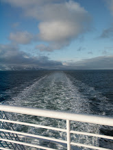
It’s 8:15pm on my last night on the ferry. I will miss the water. I won’t miss the recycled air. Or the food, even if they did serve prime rib for dinner in honor of it being New Year’s Day.
Tonight (or really I should say this afternoon, as it was 3:30pm) we had the most dramatic sunset. It was incredible. And the moon came out. I actually got pictures of the moon! I love my camera =)
I’m not sure how I feel about this being my last night. After this, I’ll be in the Lower 48. I won’t be in Alaska anymore. I will be excited to be home with my family, but right now all I feel is a sense of loss. I truly loved Alaska. I loved the winter, the slush (though the slush in Anchorage is not nearly as bad as the slush in Ketchikan; talk about gross), the clouds, the briefest glimpses of sunlight, the mountains.
Oh, my mountains. How I loved my mountains. I have more pictures of mountains than of people (really, people are secondary; mountains are tops) or of animals (mostly because the animals were hiding the entire time I was in Alaska; but whatever, I’m not bitter).
I will miss the people, too. Everyone was fabulous, which is really hard to attain.
In honor of this being my last night in Alaska (though, technically, I think we’re actually in Canadian waters by now, but the boat’s from Alaska, so it’s like a tiny moving Alaskan island, really) I’m going to make a list of my favorites from the past six months.
Restaurants
The Glacier Brewhouse
Gwennie’s
Leroy’s (top favorite dive)
Moose’s Tooth
Bear’s Tooth
Taco King (a genuine taqueria in Alaska, oh so important for a Texas native)
Places
Anchorage
Palmer
Whittier
BN (of course)
People (in no particular order)
The entire staff of BN 2784 (amazing people, one and all)
Koji
(a special shout out to my girl, Reggi, I will definitely miss those cashwrap convos between customers)
Memories
Powerline Pass at twilight
Snow-covered mountains at night (they glow)
Leroy’s at 2am after Brisingr party
Driving through falling snow at midnight
Breakfast at my kitchen table with a view of My Mountain
Journey to the Edge of the Universe
Black Books
Taking pictures while driving Seward Highway
Moose
Cache
Scrabble/Trivial Pursuit
Skypin with my Sistagirl
Any one of a hundred laughs at work
Alaska Zoo
Futon moving
The road to Flat Top
Anchorage at night
Snow
Oh, how I will miss the snow. Walking in it, driving in it, sliding on it, falling on it. I never got to build a snowman. Guess that means I’ll have to come back =)
Well, that’s all for now. This blog and all my pictures will be uploaded sometime in the coming week. Next time I get internet, whenever that might be. Probably Vegas. I’m staying in the Luxor Pyramid! Whoo hoo! I will definitely be posting pictures of that. Miss y’all. See some of y’all soon!
It’s 8:15pm on my last night on the ferry. I will miss the water. I won’t miss the recycled air. Or the food, even if they did serve prime rib for dinner in honor of it being New Year’s Day.
Tonight (or really I should say this afternoon, as it was 3:30pm) we had the most dramatic sunset. It was incredible. And the moon came out. I actually got pictures of the moon! I love my camera =)
I’m not sure how I feel about this being my last night. After this, I’ll be in the Lower 48. I won’t be in Alaska anymore. I will be excited to be home with my family, but right now all I feel is a sense of loss. I truly loved Alaska. I loved the winter, the slush (though the slush in Anchorage is not nearly as bad as the slush in Ketchikan; talk about gross), the clouds, the briefest glimpses of sunlight, the mountains.
Oh, my mountains. How I loved my mountains. I have more pictures of mountains than of people (really, people are secondary; mountains are tops) or of animals (mostly because the animals were hiding the entire time I was in Alaska; but whatever, I’m not bitter).
I will miss the people, too. Everyone was fabulous, which is really hard to attain.
In honor of this being my last night in Alaska (though, technically, I think we’re actually in Canadian waters by now, but the boat’s from Alaska, so it’s like a tiny moving Alaskan island, really) I’m going to make a list of my favorites from the past six months.
Restaurants
The Glacier Brewhouse
Gwennie’s
Leroy’s (top favorite dive)
Moose’s Tooth
Bear’s Tooth
Taco King (a genuine taqueria in Alaska, oh so important for a Texas native)
Places
Anchorage
Palmer
Whittier
BN (of course)
People (in no particular order)
The entire staff of BN 2784 (amazing people, one and all)
Koji
(a special shout out to my girl, Reggi, I will definitely miss those cashwrap convos between customers)
Memories
Powerline Pass at twilight
Snow-covered mountains at night (they glow)
Leroy’s at 2am after Brisingr party
Driving through falling snow at midnight
Breakfast at my kitchen table with a view of My Mountain
Journey to the Edge of the Universe
Black Books
Taking pictures while driving Seward Highway
Moose
Cache
Scrabble/Trivial Pursuit
Skypin with my Sistagirl
Any one of a hundred laughs at work
Alaska Zoo
Futon moving
The road to Flat Top
Anchorage at night
Snow
Oh, how I will miss the snow. Walking in it, driving in it, sliding on it, falling on it. I never got to build a snowman. Guess that means I’ll have to come back =)
Well, that’s all for now. This blog and all my pictures will be uploaded sometime in the coming week. Next time I get internet, whenever that might be. Probably Vegas. I’m staying in the Luxor Pyramid! Whoo hoo! I will definitely be posting pictures of that. Miss y’all. See some of y’all soon!
Sunday, January 4, 2009
Tired.
I'm at the Luxor.
I'm Tired.
Yes, with a capital T.
I should be asleep.
Why am I not asleep?
I have a feeling that this blog is going to suffer until I'm well rested. I will attempt to post pictures at a later date.
(Maybe somewhere I DON'T have to pay $14 for WiFi)
But tomorrow I pick up Sarah and Koji from the airport. Yay!
Now I just have to make room for them and all their stuff...
I'm Tired.
Yes, with a capital T.
I should be asleep.
Why am I not asleep?
I have a feeling that this blog is going to suffer until I'm well rested. I will attempt to post pictures at a later date.
(Maybe somewhere I DON'T have to pay $14 for WiFi)
But tomorrow I pick up Sarah and Koji from the airport. Yay!
Now I just have to make room for them and all their stuff...
Friday, January 2, 2009
Juneau, Land of Giant Christmas Trees
And I do mean giant. I'm talkin 60 - 70 ft Christmas trees. Flocked.
Amazing. I don't really have pictures of those, cuz it was too dark when I was passing them to take pictures, but here are the pictures I do have. There aren't very many. I didn't do much in Juneau except sleep and go to Fred Meyer to print pictures. And get a gingerbread latte. Oh so important.


 Hotel = amazing. If you have to stay in Juneau, stay there - Frontier Suites Aiport Hotel.


 That's a quilting store across the street from my window. Great views of the parking lot.


 This will forever be my overwhelming memory of Juneau. Giant Christmas trees lining the road, obscuring everything, and covered in snow.


View from the parking lot of the post office.
Amazing. I don't really have pictures of those, cuz it was too dark when I was passing them to take pictures, but here are the pictures I do have. There aren't very many. I didn't do much in Juneau except sleep and go to Fred Meyer to print pictures. And get a gingerbread latte. Oh so important.


 Hotel = amazing. If you have to stay in Juneau, stay there - Frontier Suites Aiport Hotel.

 That's a quilting store across the street from my window. Great views of the parking lot.

 This will forever be my overwhelming memory of Juneau. Giant Christmas trees lining the road, obscuring everything, and covered in snow.

View from the parking lot of the post office.
Subscribe to:
Posts (Atom)